405 Livability Plan
Client: LA Metro
Location: LA County, LA
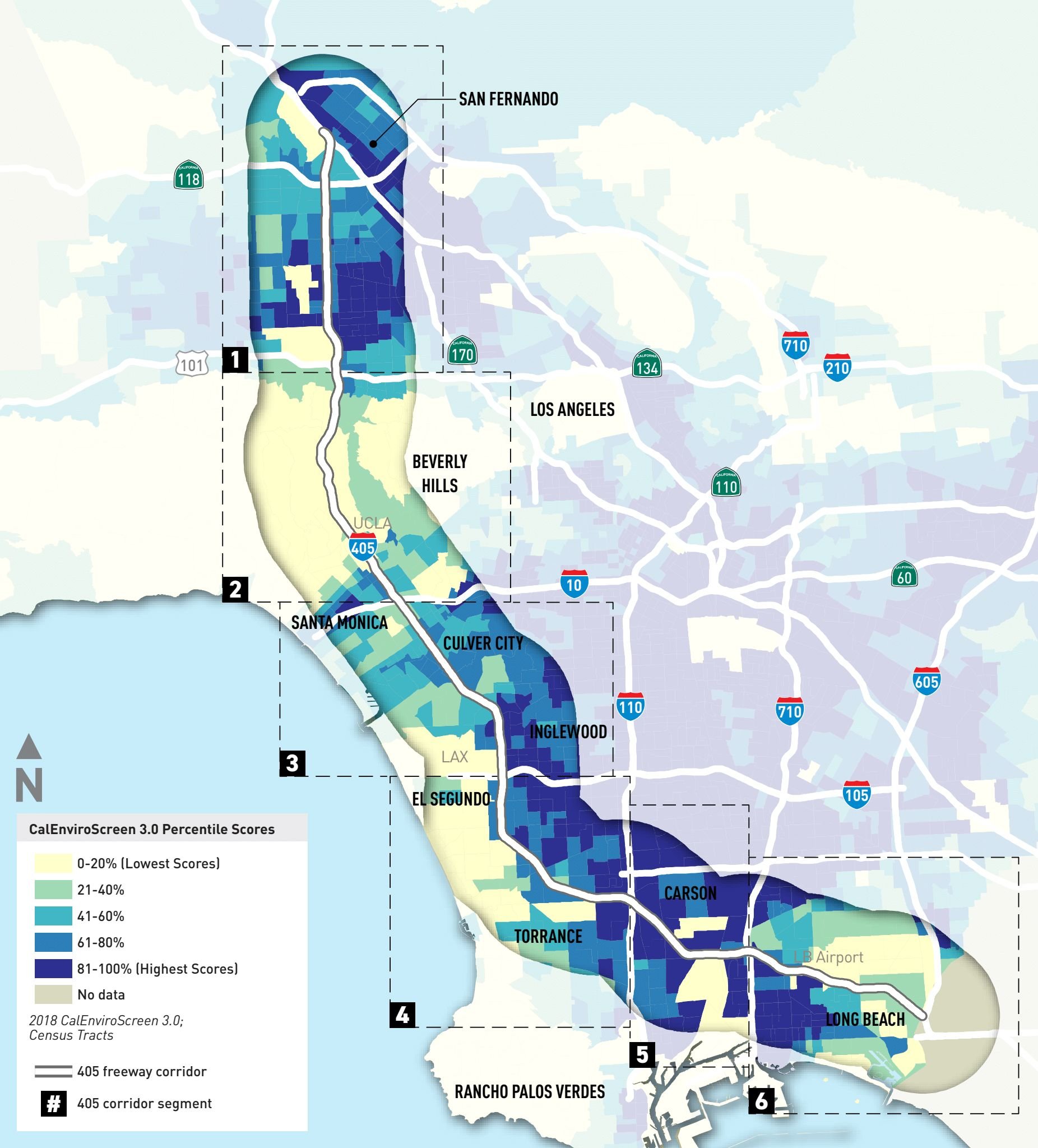
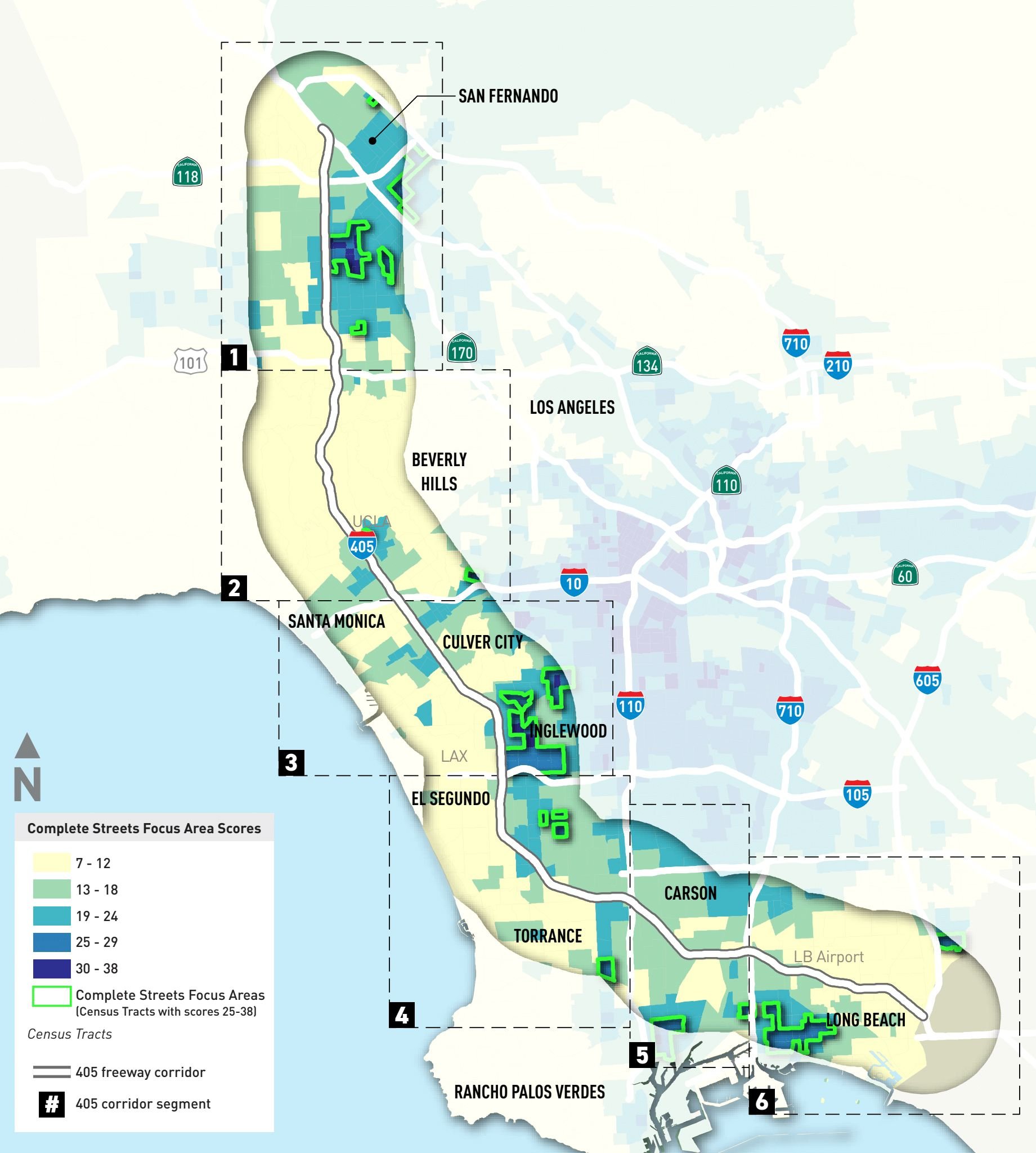
HERE took a data deep dive for this Livability Plan along the I-405 Corridor through Los Angeles County. We analyzed land use patterns, equity, connectivity, and social demographics to generate a set of key corridors that should be transformed into Complete Streets to better serve the people who need it the most. The identified corridors connect transit-dependent and disadvantaged communities with services and destinations. We illustrated our findings through a series of maps and diagrams to paint a picture for the community and our client, LA Metro.